What's new in Tacnav: NATO symbols, line of sight and offline maps

On this page
This is the biggest Tacnav update since launch: standard NATO symbols for markers, line of sight and sectors, geofencing alerts, offline maps for when there's no signal, more base maps, and a web command post that now works like the app.
NATO symbols for markers
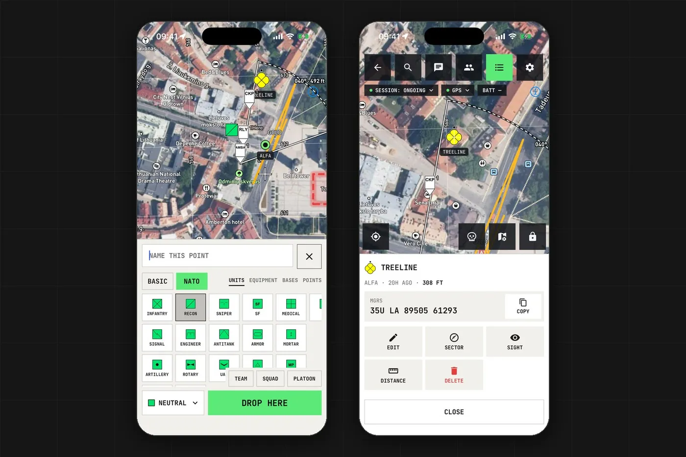
The marker sheet now has a NATO tab next to Basic, with standard MIL-STD-2525D and APP-6D symbols in four pages: Units, Equipment, Bases and Points. Pick a side and, for units, a size such as team, squad or platoon.
Control points number themselves (CKP 1, CKP 2), and players can swap their dot for a NATO symbol from Members, Change icon.
The Enemy button now drops a hostile NATO marker named Enemy in one tap. It stays on the map like any other marker.
Line of sight and sectors
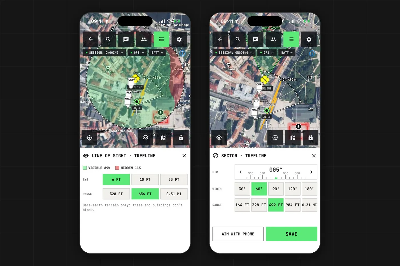
Tap Sight on any marker or teammate to see what ground is visible from there: green is visible, red is hidden, out to 100, 200 or 500 metres. It uses bare-earth terrain, so trees and buildings don't block the view.
Sector draws a field of view: set a direction, a width from 30 to 180 degrees and a range up to 500 metres, or aim with your phone. Everyone in the session sees it.
Lines also show a height profile, so you know how much a route climbs before you walk it.
Geofencing alerts for areas
Any area can raise an alert when someone enters or leaves it. Choose whose movement counts and who gets told, for example to know when a squad reaches the rally point or someone leaves the play area.
Offline maps
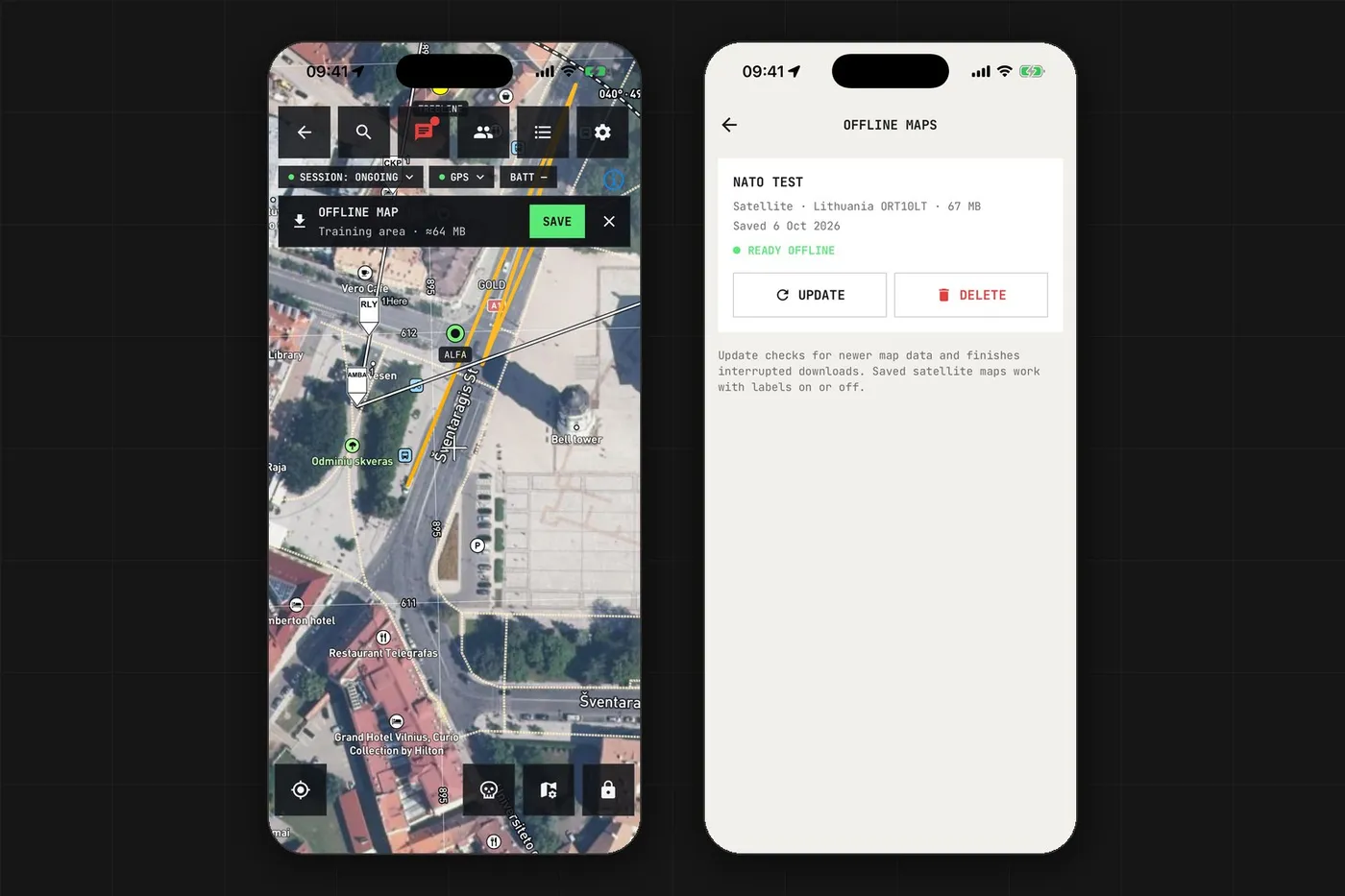
Signal at game sites is often weak, so maps can be saved on the phone: Map settings, Save this area. Saved maps are under Menu, Offline maps.
Organisers can mark the play area in the organiser console on app.tac-nav.com, and players get a small card offering to save it.
Detailed imagery is saved with the area automatically: ORT10LT in Lithuania, USGS imagery and topo maps in the US.
More base maps
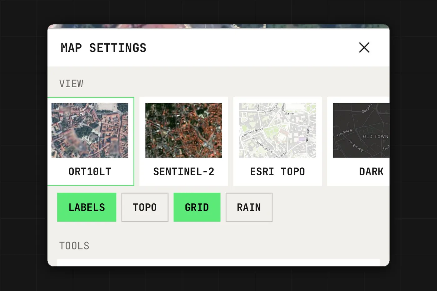
Map settings now offers Esri, USGS Imagery and Topo (US), ORT10LT (Lithuania), Sentinel-2 and Esri Topo next to Mapbox, Dark, Outdoors and Streets. Labels, Topo, Grid and Rain work on top of any of them.
The web command post
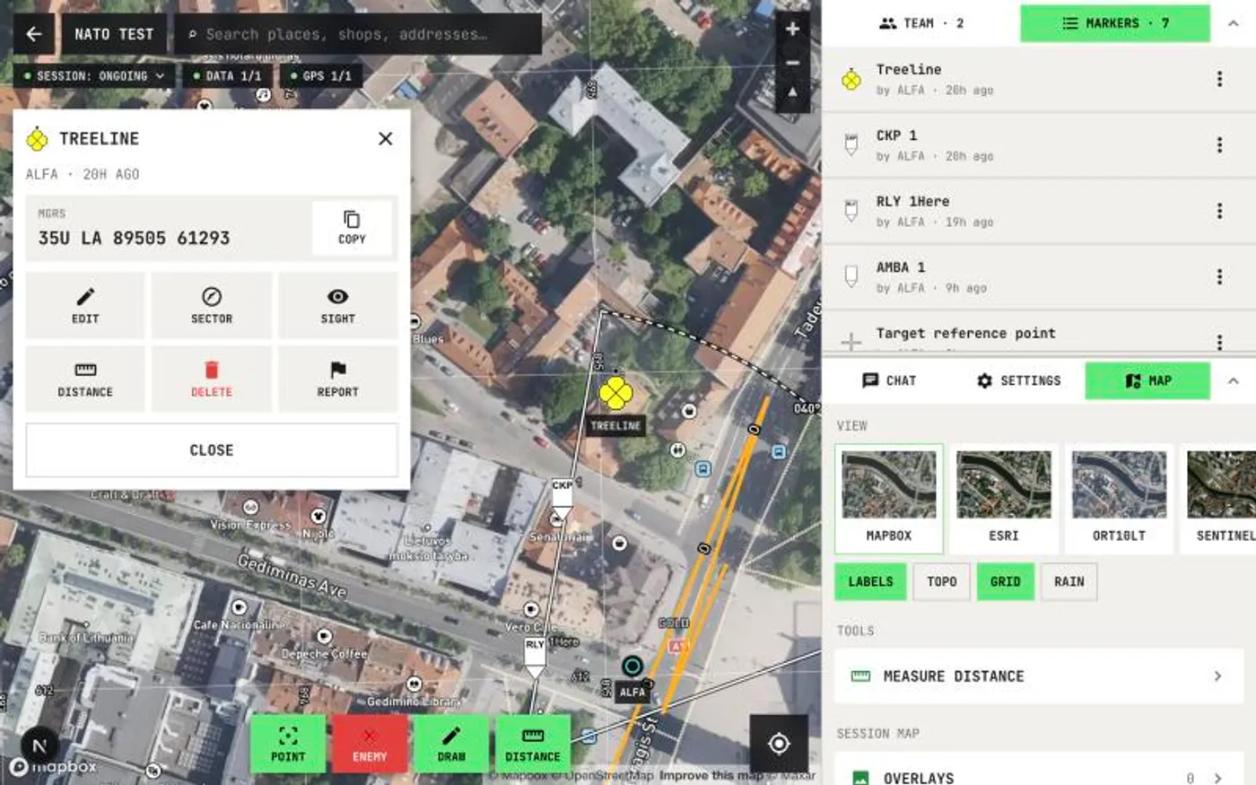
The command post at app.tac-nav.com now matches the app, laid out for a big screen: the same cards, NATO symbols, line of sight, sectors, alerts and base maps. Opened markers and players are centred beside their card.
The update is live in the app and on the web. Questions or problems: Menu, Help and support.
Tacnav
Put your whole team on one live map.
Positions, markers, routes and chat in a private session. Join with a QR code, no server to set up.